Google Earth can be used to set the Latitude and Longitude of the SketchUp model, as well as using the terrain as part of your topographical surface for analysis. Firstly you need to install the Google Earth plug-in into SketchUp. ( http://www.SketchUp.com/index.php?id=408 )
Once installed follow the steps below!
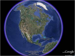
Step 1: Open Google Earth
Step 2: Navigate to the building location
Step 3: Get the current view from SketchUp.
Step 4: Open Set Building properties [Latitude and Longitude will have updated]
Note: you will need to add the City name.
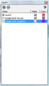
Step 5: If you would like to translate your terrain as part of the topographical surface. In the Layers dialog, turn on the Layer ‘Google Earth Terrain’ and turn off ‘Google Earth Snapshot’, you will should see the actual terrain.
Step 6: Go to the ‘Select Groups’ dialog, and select ‘Shade’ with the Google Earth Terrain.
Step 7: Click on ‘Identify Rooms’, and your terrain will translate as shading surfaces for your model.

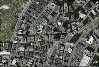
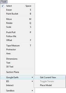 Step 3: Get the current view from SketchUp.
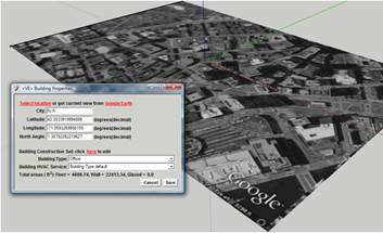
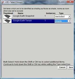 Go to the ‘Select Groups’ dialog, and select ‘Shade’ with the Google Earth Terrain.