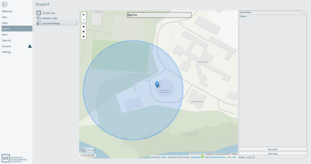
3D building objects can be imported via Open Street Map (OSM). A map, location search box and zoom controls are used to find the area requiring import. The search tool provides a list of matched locations with matching pins on the map. Select a list location or pick an icon (pops up a dialog with zoom to location) to zoom to the location.
Three selection box tools are provided (square, circle and polygon) that allow a regular or irregular capture area to be defined. The capture area is imported by selecting import data and the OSM data is then imported and will appear in the 3D workspace view.
Figure3-15: Geometry can be imported from Open Street Map to create building objects within iVN.
The import feature processes geometry and tag data from OSM. As OSM data is publicly edited, it varies in extent and quality.