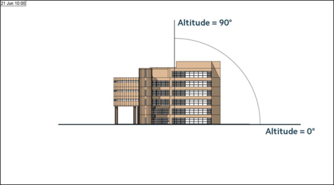
The altitude angle range is from 0° to 90° from the horizontal to vertical axis, see below. To generate this elevation view, the Altitude was set to 0° to create an elevation, and the Azimuth set to 90° to view it from the East.
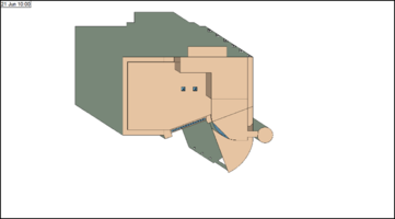
As such, to generate a plan view of shading where North is to the top of the page, as per usual, the Altitude needs to be set to 90° to be directly overhead for a plan view, and the Azimuth needs to be set to 180° as the viewing position in SunCast is effectively the bottom of the screen, as we can see in ModelViewer II.
If we were instead to use an Azimuth of 0° as the viewing position in SunCast, this would mean we were viewing the model from the North, so even if we set the Altitude to 90° for a plan view, our shading plan will show with North to the bottom of the screen – i.e. upside down by most drawing conventions.
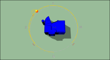
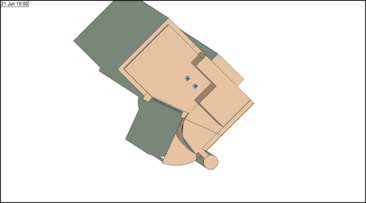
The Azimuth will be determined by the rotation of the building set in ModelIT, not by the view in the model window. A building with a site rotation of 45° is shown in the image below, with the Azimuth set to 180° and the Altitude set to 90°, so that North is up the screen.